We Value Your Privacy
We use cookies to enhance your browsing experience, serve personalised ads or content, and analyse our traffic. By clicking 'Allow All', you consent to our use of cookies. For further details, please see our cookies policy.
We use cookies to enhance your browsing experience, serve personalised ads or content, and analyse our traffic. By clicking 'Allow All', you consent to our use of cookies. For further details, please see our cookies policy.
A question we often get asked is how we come up with our unique adventure concepts. It’s a fact that if you were to pick up “anyone else’s brochure,” none of our trips can be found there. All of our event concepts both in the UK and worldwide are bespoke, tailor made to the country and the landscape and spellbindingly unique. So, when the Madeira tourist board got in touch with Rat Race to invite us to visit their island to see if we could come up with something brand new, the first thing we did was whip out a map.
These days, that means Google Earth. You can’t beat a good old-fashioned paper map to really get a sense of scale and terrain; but Google Earth and other online tools are amazing.
Anyone doing a quick zoom-in of Madeira will see how ideal this place looks at first glance, for adventure: A dramatic mountain spine rising to nearly 2000m above sea level forms crashes down either side to sheer cliffs, steep forested slopes replete with fairy-tale waterfalls plus the odd black-sand volcanic beach.
Often referred to as the ‘Hawaii of Europe,’ the maps didn’t lie. It had the minerals, it looked ripe for adventure and we were excited to get on the ground and have a poke around.
In a world where the world is literally mapped online trail by trail, information can be overwhelming and a starting point and tangible “handrail” is always needed to steer the concept from the off.
When we arrive in a location, sometimes you just need an old fashioned paper tourist map, a good coffee (or something stronger) and a lazy couple of hours at the drawing board with a well-renowned local guide.
Local knowledge is essential in these early planning stages; someone who knows the place like the back of their hand and is an unequivocal expert in how a place works together, what suppliers are available and what may or may not be possible. Can’t isn’t normally a word we hear or are willing to accept!
The overview of the whole island on paper lets us start to visualise how we can traverse Madeira in a way that hasn’t been done before.
Rat Race adventures always have a tangible objective: A pinnacle moment or a destination as a goal for example. We always arrive to produce an unbroken self-powered journey giving people that ‘I got here under my own steam’ feeling when they cross the finish line. That’s our special sauce.
Madeira was no different. The route has to flow; it can’t be convoluted. That sometimes takes a lot of work. When the terrain is so sheer that the majority of the coastal road is in a tunnel, or spanning a bridge, you have to think hard about these things.
We travelled to Madeira with an open mind and no distinctive plan; apart from an inkling that perhaps we wanted this to be multi-sport. Because that has never been done here before.
On the first day we jumped in the car and travelled all over the west of the island investigating different locations and trying to understand how possible kayaking locations might work, how the trail network connects up; and the different ways we can join the dots. The information was overwhelming and the landscape is impressive but challenging, meaning that sometimes the answers don’t come easy or immediately.
Whilst on paper, trails look abundant, when you’re on the ground, things can look a lot different. Here in Madeira, trails are steep and localised to specific areas where access by foot is possible. The roads are fast and functional - which means they aren’t cycling roads. At the end of day 1 we had explored for about 13 hours and the concept hadn’t come to us naturally. We’d seen a lot but the special sauce was eluding us.
Retreating for some local wine and yet another Pastel de Nata, plus copious local tapas, we brainstormed the initial findings and honed in on recce locations for the next day. Tomorrow we would explore the east of the island, hoping that the morning would start letting us link some of these ideas together.
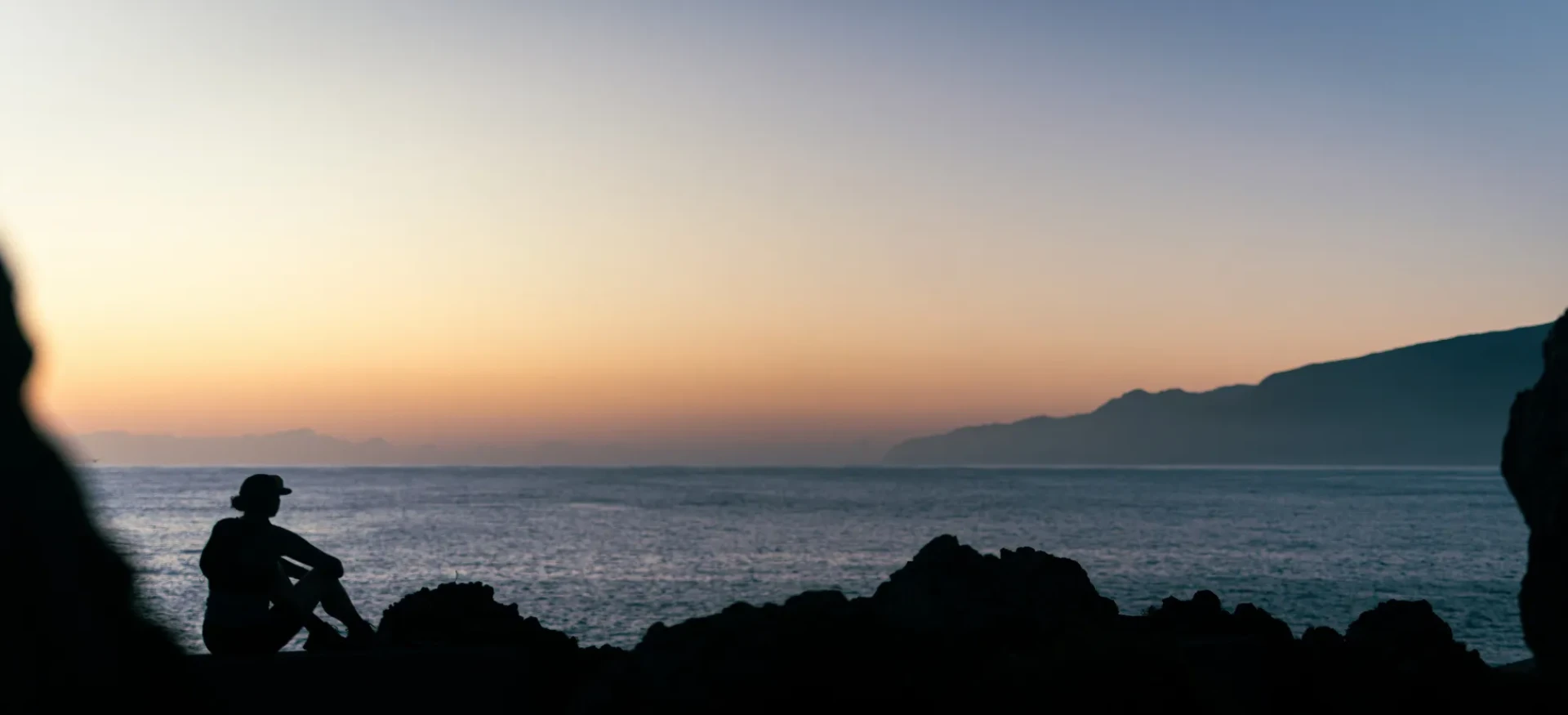
We headed out early to the very eastern tip of the island to visit Sao Lourenco - if you know our adventures you know we love a point to point journey: Tip to Toe, Toe to Tip, Coast to Coast, Sea to Summit…the list goes on! So we wanted to go to the an absolute end point of Madeira and take a look at the sea conditions, consider the access and figure out if we could start an adventure there. On the map there is a small island just off the mainland that looks like it has some good boat access.
We consult our guides and investigate if this will work for some kayaking. Whilst Madeira is surrounded by water, it’s exposed to the harsh Atlantic waves and swells. So whilst there is a lot of sea, it doesn’t necessarily follow that we can use it all. There’s a lighthouse on that island that is serviced by local boats. Just so happens there’s a lighthouse at the opposite end of the island, too. Boom! Like that, the potential “bookends” of the adventure fall into place. Now we have to connect them; join the dots.
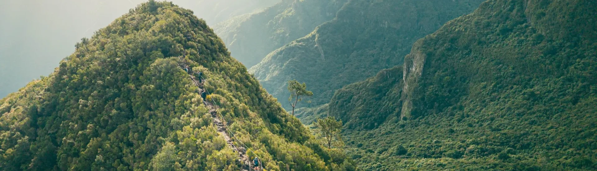
We head up to the quieter and sensationally dramatic north coast and into some of the most beautiful coastal cliff trails we’ve ever seen. Dizzyingly dramatic drop offs into the sea cascade down on one side and vertiginous greenery rises on the other. This really is Jurassic Park. We visit and hike along a “Levada” - ancient irrigation waterways completely unique to Madeira that run all over the island. The map comes back out, more coffee, more Pastel de Nata, a quick beer, grilled meat. We look at connecting the east and the west, the south and the north. We work in a Levada before drawing a hiking/ running route into the rugged mountains of the interior.
So we have kayaking and we have trekking/running. Now how do we work biking in? Madeira is becoming more and more popular for mountain biking and there are some amazing downhill trails that offer spectacular riding. But these trails are only located in one area of the island. The challenge is now getting a chunky amount of distance in the saddle alongside taking in some epic trails…one we’re still working on with local contacts and experts to come up with something incredible...
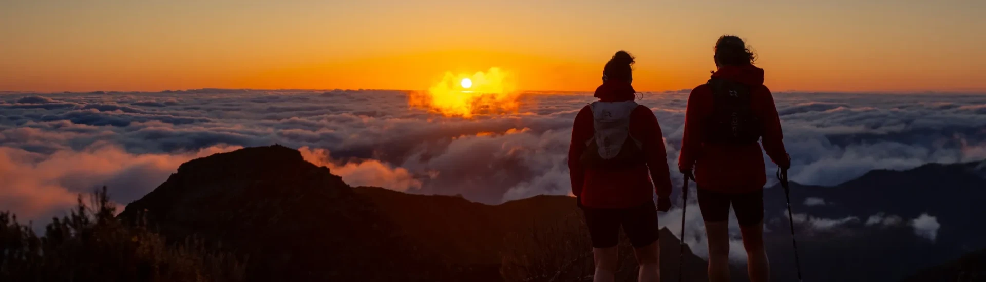
With a rough plan in place, we get up early on our last day to catch sunrise on the famous trek between Pico do Arierio and Pico Ruvio - which is the iconic route you see all over Instagram and one we will be planning to include in our route. It was a punchy morning. But so worth it for these sublime views.
After that? We had time to taste some Madeira wine and have another majestic tapas board before we hopped on the plane home, excited, inspired and ready to work on our findings. It was time to plan the test pilot, before introducing this event to our ever-growing catalogue of adventures.